M6.2 offshore quake northeast of Maluku Barat Daya, no tsunami risk
Indonesia’s BMKG recorded a magnitude 6.2 earthquake in the Banda Sea, about 166 km northeast of Maluku Barat Daya, on Friday evening, 11 September 2026.
Editor: Mursyid Sonsang
· Event date: · 3 min read
Makassar — A magnitude 6.2 earthquake struck offshore northeast of Maluku Barat Daya on Friday evening, 11 September 2026, with Indonesia’s Meteorology, Climatology and Geophysics Agency (BMKG) reporting no tsunami potential.
According to BMKG’s earthquake information and felt reports, the quake occurred at 18:56:24 Western Indonesia Time (WIB) and was located in the Banda Sea, about 166 kilometers northeast of Maluku Barat Daya Regency in Maluku province.
BMKG placed the hypocenter at a depth of 143 kilometers, classifying the event as a deep-focus offshore earthquake. The agency’s tsunami modeling indicated that the quake did not have the potential to generate a tsunami, a point that was highlighted in several media reports citing BMKG’s statement.
Epicenter and shaking
BMKG reported that the epicenter lay at approximately 7.44 degrees south latitude and 129.11 degrees east longitude, in the Banda Sea northeast of Maluku Barat Daya. The location places the source well offshore, which, combined with the depth, helps explain why the shaking was felt but not widely reported as damaging.
BMKG’s “felt earthquake” list notes that the tremor was experienced in Tiakur, the regency seat of Maluku Barat Daya, with an intensity of III on the Modified Mercalli Intensity (MMI) scale. Intensity III MMI generally corresponds to weak shaking that is felt indoors by some people but typically does not cause structural damage.
BMKG’s assessment
In its online bulletin and updates on social media, BMKG described the quake as a tektonic event originating in the Banda Sea and confirmed that it did not trigger a tsunami warning. Media reports quoting BMKG reiterated that the quake was centered in the sea, around 166 kilometers northeast of Maluku Barat Daya, at a depth of 143 kilometers, with magnitude 6.2.
BMKG stated that, based on its monitoring, no aftershocks had been detected in the immediate aftermath of the event. The agency continued to monitor seismic activity in the region as part of its routine operations.
Reports of impact
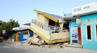
As of the latest media coverage following the earthquake, outlets citing BMKG and local information reported no confirmed fatalities, injuries or significant damage linked to the event. Reports emphasized that, despite the relatively strong magnitude, the combination of deep hypocenter and offshore location limited the impact on populated areas.
Several national and regional news organizations noted that authorities had not received major damage reports and that there were no disruptions to services reported at the time of their publication. However, they also indicated that monitoring continued for any subsequent information about impacts.
Seismic context
The Banda Sea and wider Maluku region lie in a complex tectonic zone where several plates interact, making the area prone to moderate to strong earthquakes. BMKG’s catalog lists this 11 September 2026 event among significant quakes recorded in eastern Indonesia that month.
Residents in Maluku and surrounding regions are routinely advised by BMKG and local disaster agencies to stay alert to official updates following felt earthquakes and to follow local guidance on preparedness and evacuation procedures where necessary.
Sources
- BMKG – Gempa Bumi M6,2 – 250 km BaratLaut MALUKUTENGGARABRT
- RRI – Gempa Magnitudo 6,2 Guncang Maluku Barat Daya, Berpusat di Laut
- Okezone – Gempa M6,2 Guncang Maluku Barat Daya, BMKG: Tidak Berpotensi Tsunami
- Liputan6 – Gempa Magnitudo 6,2 Guncang Maluku Barat Daya
- Metro TV News – Maluku Barat Daya Diguncang Gempa Magnitudo 6,2, Tidak Berpotensi Tsunami
Next story
Lasiana launches waste bank with support from Nusa Cendana University
Lasiana’s new waste-bank unit in Kupang aims to turn household and tourism waste into community income, with Nusa Cendana University providing digital…
Related